
Features 世界の国
Displays detailed information, national flags, and maps of 198 countries around the world.
Maps can be registered in the database and can usually be displayed in four types: satellite, satellite +, and terrain.1.
1.
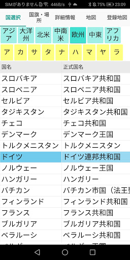
Country selectionTouch the region or Akasatana, and then touch the country you want to display.2.
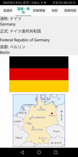
National flag / locationThe official country name, capital, national flag, and country location of the touched country are displayed.3.
3.
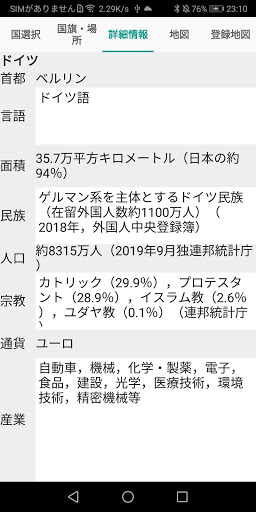
Detailed informationThe capital, language, area, ethnicity, population, religion, currency, and industry of the touched country are displayed.4.
mapThe map of the touched country is displayed.
The map is enlarged with + and reduced with-.
The map can usually display four types: satellite, satellite + (adding a place name to the satellite), and terrain.
Touch Register to register in the database.
Move the Orientation and Angle track bar to change the Orientation and Angle on the map.5.
Registration mapIt is a database of registered maps.
You can sort the map in ascending order, date and time descending order (from new registration), latitude descending order (north to south), and longitude descending order (east to west).
Normally, if you touch satellite, satellite +, or terrain on the map display toolbar, the map registered in the database will be displayed at the scaling ratio at the time of registration.
Gaming Features
Enjoy immersive gaming experience with various game modes.
Learning Tools
Enhance your learning experience with interactive features.
See the 世界の国 in Action
Get the App Today
Available for Android 8.0 and above